Wednesday, October 16, 2013

Bouncing through Benjamin

Impression Report 4
Land of Benjamin
9/22/13

            Benjamin, or as Jacob called him a “ravenous wolf” became a people of in-between places. The inheritance of the tribe of Benjamin is a belt of land that lies in the middle of the land of Israel just to the north of the dead sea and crossing from east to west through the mountains between the coastal plain and the rift valley. It's here that much of the most important roads meet. For those living in the mountains, the easiest way out of the valleys and ridges is to travel either east to Jericho or west toward Gaza. Of the two, Gaza would be a more beautiful choice. We began our day looking to the east, over wadi Qelt. A big, desolate, dry, and quiet set of valleys creating the branching network leading down and out toward the dead sea just past Jericho. This truly is a wilderness, once one crosses the watershed ridge and steps into the rain shadow in the east, the green hills change to dust very quickly. It was this wadi that we walked down today, seeing just how long a trip some of the wadi could take, even going downhill almost the whole way.
            One notable thing we discussed on this trip was Deuteronomy 32:10 that says “...He kept him as the apple of his eye.” which also means the pupil of his eye. And we talked about God looks closely at us and because of Jesus He sees Himself in us. When we look closely into God's eyes we see our own reflection there, we see ourselves as we truly are, fallen, broken, but mercifully allowed to be His sons and daughters. It was an interesting and beautiful image.

            As we descended we also passed by some wild Rock Hyraxes, or Rock badgers, reminding me of the Proverb that says “The rock badgers are a feeble folk, Yet they make their homes in the crags” speaking of the wisdom exhibited by some creatures here on earth. The Proverb in chapter 30 verses 24 through 28 says “There be four things which are little upon the earth, but they are exceedingly wise: The ants are a people not strong, yet they prepare their food in the summer; The rock badgers are but a feeble folk, yet make they their houses in the rocks (a wise and safely guarded place); The locusts have no king, yet they go forth all by rank (speaking of locust swarms moving as a single swarm); The spider taketh hold with her hands, and is in kings' palaces.” An interesting and more current translation for the final line renders it “the lizard can be grasped in the hand, yet it is found in kings’ palaces,” which is the very state of things here at JUC. Not many spiders have I seen here on campus, but geckos and small lizards I have.

            As we finished our descent we landed in the area of Jericho, but specifically we went to one of King Herod's palaces, right there at the bottom of the canyon mouth, where the water funneling down the wadi would have run past. It was here that we stopped and considered the vast wealth accrued by Herod. Here that we discussed how some places had tax rates as high as 80 percent, partly out of greed, and partly because it's difficult to rebel against your ruler when you're spending every moment you can trying as hard as you can just to survive, just to feed your family.

            With that poverty in mind we also discussed Zacchaeus and the taxing system. Often times the way the taxes worked was Kingpin 1 would say this region should bring me 500 coin, and the region administrator in charge of giving him those funds would tell his city heads they all owe him a total of 600 coin, and the city heads would tell their tax men they needed to gather him 650 coin and so each of those tax men would tell each individual they owed so much of that 650 plus whatever the tax man took for himself as pay. So each person along the chain would get his own slice. But also increasing by quite a bit, the total taxes taken from the people. This can explain why Zacchaeus would have been so very rich. It also would have explained why he was so very hated too. He was one of the men responsible for the extreme poverty in his region, and he clearly was benefiting from it.

            Next we went to the actual Tel where old Jericho once stood and saw some old mud bricks and stone walls. The old wall and tower unearthed there is thought to be pieces of the oldest city on earth.

           It was after this that we took the bus all the way back up towards the central Benjamin plateau, the largest, flattest part of Benjamin's land where the majority of agricultural work would have taken place.
And we followed approximately the same route that Joshua and the Israelite warriors would have taken when going up to battle at Gibeon. Marching all night from Jericho, uphill, in dry dusty conditions to start a battle, the longest battle of history, for God listened to Joshua and made the sun and moon stand still in the sky while they chased their enemy from Gibeon all the way down the Beth-Horon ridge route out to the west, then south down to Azekah. Not a short trip at all. In fact the trip as a whole should have taken them about 4 days, sleeping at night and marching all day. But the Lord helped them in the battle and they fought for many, many, many hours and chased their enemy no less than 19 miles before returning all the way back to Gilgal near Jericho. Traveling a distance about as long (in total) as the journey from the northern end of the Dead Sea, straight west to the coast. Yet more difficult for the terrain they traveled was all in the hills, not the easy straight lines of the plains near the coast.

            On our ride up to the plain we went past many Bedouin encampments and stopped to look at the soil. Some of it was alluvial, composed of both Senonian(rendzina) and Cenomanian(tera rosa) derived soils. It was rather clay like, and best suited to farming crops that had strong enough roots to penetrate through the clay nature of the soil. Sand added to the clay helps to break it down some, but in the end, the soil there was only so useful. Some Bedouin were preparing the soil for planting of the winter wheat and barley.


We paused to examine some of the dirt of the region and found a boundary marker. Andrew likes taking pictures of Alana taking pictures. 

            We also passed (as typical for Israel) many olive orchards. And saw in the distance a stone quarry, which is also expected since concrete and stone are the most common tools of construction here.

            After we went to the lookout at Nebi Samwill we had a very good idea of the Benjamin plateau's size and geography, being able to see the majority of it at once.


From there we went to tel Gezer where we could barely see the ocean, and on the other side we could see the hills we had just come out from. We also looked at the six chamber Solomonic gate. And I was announced king of Hawaii who married Alana princess of Montana so that our countries would have beneficial trade agreements. And how I would have erected an embassy for her country which would have been a temple to worship her Montanan god Yeti.


Crowning Andrew King of Hawaii


Tuesday, October 1, 2013

Bowling

I know it seems like it from my blog posts, but we don't ONLY go on field studies here at JUC.  Various other activities fill our lives, both mundane and unusual, all filled with the foreign familiarity of life here.  A recent activity that we joined in with other students was bowling.

I am not a big bowler.  There have been times when I've been lucky to have a final score in the double digits, shamefully enough.  So when I'm thinking of fun things to do, bowling pretty much never even makes my list, much less gets to the top.  This is doubly true in Israel, where, hey, do they even HAVE bowling alleys?

So you can imagine my surprise when I found myself at a bowling alley, here in Israel...not once but TWICE in the last few months.

It turns out that, yes, they DO have bowling here.

Now, I have to admit, I have no idea what state bowling is in back in America.  Like I said, I rarely frequent bowling alleys, and I think the last one I was at is a tiny one in Big Timber, Montana: six lanes, dark, smokey...  And what I can remember of bowling lanes from my youth (when it was considered a treat to go on a field trip to go bowling) is much the same: dark and smokey (if not always quite as tiny.)  And, of course, having to rent rather gross shoes, worn by who knows how many other people, which never fit quite right.  And having to go pick out a ball from the myriad of mostly black but occasionally colored, shiny balls in racks along the wall.

This is not exactly the state of bowling in Israel.

For one thing, instead of the dark, smokey, wood-paneled basement-type areas I seem to remember, Israel favors brightly colored paint jobs.  And one of the bowling alleys I went to was actually up stairs about 3 flights.  Who puts a bowling alley on a roof?  Just seems odd.

For another thing, the computers that keep track of score now have cutsie little animations that either celebrate you getting a spare or a strike, or mock you for your inability to do so:
And....no spare.  :P
For another thing, all of the balls seem to be brightly colored, but also rather worn and tattered.  And if you don't like what is in your lane when you get there, you'd better hope you can trade with another lane, because that seems to be all there is.

On the plus side, they don't make you rent shoes from them.

On the minus side, we quickly understood why EVERY LANE had the bumpers up (to block off the gutters) before we arrived.  We put ours down and then quickly regretted it.  The lanes maybe have a tendency to be warped and dinged more here...possibly because of the bowling methods employed by most of the natives (throwing overhand, bouncing along the ground, ricocheting the ball back and forth on the bumpers, running down the lane a ways to try to make a good shot)... at any rate, gutter balls were extremely common.


I have to say, though, for myself, I've had pretty good luck bowling here in Israel.  The highest score I can remember having previously is maybe in the 50's or 60's.  My first time bowling here I scored over 80, which was exciting for me.  This last time, I broke 100, and apparently had the highest score of the night in our group.
Pretty exciting for a little Montana girl who's terrible at bowling.  

Tuesday, September 24, 2013

Jerusalem Approaches

Impression Report 3
Jerusalem Approaches
9/20/13
by Andrew Sharp
[with a few notes and corrections by Alana]


            In this field study we looked at the different approaches to Jerusalem, and it's surrounding geography. We started at a look out point north east of the city where we could see some of the landmarks; the temple mount and mount of olives in particular were close and easily visible. While we were here we also looked at an old family tomb, as likely would have been the style of tomb Jesus was put in. These tombs often had large rolling stones as their doorway, just like is mentioned in Scripture. Inside they would have some form of table area where the body could be laid, and individual kokhs (spelling?). Or small tunnels into the rock built for the bodies to be 
placed into once they were properly prepared. Jesus wasn't properly prepared, something attested to in Scripture by both the quickness of his being placed in the tomb, in preparation for Shabbat, but also by the need for the women to carry spices to his tomb after the Shabbat was over. The spices were for his body's preparation to be placed into one of these kokhs where his body would have decomposed to the point of being bones, then likely would have been put into an ossuary, a small stone box to hold his bones. But as we know, they found no body in the tomb when they arrived.
            Next we took the bus a bit further east where we could get out and see just how stark of a contrast a rain shadow can be. On one side of the hill, green, on the other, brown. We were able to barely see the dead sea as well.
            Moving south onto the mount of olives, we stopped and looked over all the tombs on the hillside. This also gave us one of our best first looks at the eastern wall of the temple mount. Or at least the first good view we've had where we could see all of it at once.
            Next we walked down to the Necropole, [at Dominus Flevit] aka house of really old bones. And I don't recall for sure, but I think Vernon said the most ornate one was thought to be the Ossuary of James, brother of Jesus, and that Gabbi believes it's the real thing. [??]
Walking down the Mount of Olives
In the church at Dominus Flevit
            Garden of Gethsemane! Yup, we went there. Had some really old olive trees. Maybe close to a thousand. Super old, hollow. Vernon told us how it was likely that the garden was more likely something of an industrial complex for the production of olive oil. After all, it's the mount of olives. And he pointed out the likely hood of there being caves, and many people who could have been in this garden/complex. Making it necessary for Judas to point out Jesus to his captors. After all, saying “a jew on the mount of olives” would have left them with quite a few choices, not just 10 or 15. We also checked out the church on site. Dimly lit, filled with pictures of Jesus praying for the cup to be taken from him, tall pillars, alabaster windows that let light in through cross shapes, beautiful place.
            Then we got lunch. And ate ice cream.
            Then Sataf! West of Israel. Where I had a son named Eric, a real good man, and my wife and I married him off to Mike and Havvah's daughter Hannah. While we played in the terra rosa soil, discussed family life, and how it'd be super hard to keep a cave or stone house warm in the winter. And how the agricultural land was a lot of hard work. Requiring years for terracing, and requiring rain fall and God's blessing just to get by. As well as the danger of childbirth. Plus there were grape vines and walnuts and almonds being grown, it was pretty cool.

Us under Herodian
            Next we went to the Herodium. 
Got some interesting pictures, in particular of a doorway that seems to have had part of the crossbeam supporting it, removed. Alana suggested it may have been made of wood and in order to preserve the building they put in some concrete and rebar in the stone blocks above where the wood beam once sat, and never replaced the wooden beam, leaving doorways that looked like fat letter T's. Plus we went into the tunnels carved out below it, and could see Jerusalem from there, barely, kind of sorta. And giant round rocks that would have been rolled down onto enemies attempting to scale the fortress. 

And last we wen to the shepherds field.


[After leaving the church we stopped at a nearby store - our drive knew the owners, of course.  They had a lovely sign... 

...and some truly lovely olive wood carvings.  We rather liked this triclinium version of the last supper:]

Jerusalem Field Study - Andrew's Persective

Impression Report, Biblical Jerusalem Field Study
Andrew Sharp September, 9th, 2013

            Where: We went to a part of the old “broad” wall thrown together from rubble, we went past the dig that wasn't too far from the Temple Mount where gold coins were discovered recently, to an outlook above Hezekiah's Tunnel, through Hezekiah's Tunnel, through the old sewer line that lead towards the Davidson's Center, had lunch, went to the approximate location of the upper room went to the Davidson's center, a ritual cleansing room called a micvah then to the south west corner of the temple mount, the Southern Steps, 
then St. Anne's church/the sheep pools/
pools of Bethesda, then home.
Last stop of the day: Bethesda

            Details: First we went to the “broad wall” a wall built by Hezekiah in response to the approaching Assyrian army. It was hastily thrown together and as a result wasn't as neatly built or as organized as most of the walls. Mostly it looks like they took rock and tossed it into a pile and put some semi-faced and semi-organized rocks on the outside edge to make it function as a wall. It even appears to have cut through some houses in their hurry to get it built.
            We passed quickly past the location of the Ophel excavation (I believe that was the one?) where some gold coins and artifacts were uncovered recently with quite the claim about their age.
            Then stood far above the entrance to Hezekiah's tunnel and looked down into the Kidron valley at lots and lots of trash. Namely the filling of the valley some 40-60 feet by all the trash that collected there through history.
            Next we went through Hezekiah's tunnel. To this day water still runs through it, though not in the same amounts or intervals. The whole of the hike was down hill of course, but gently so as we wandered in the dark underground shaft, to the constant noise of our feet splashing in the ankle, calf, and sometimes knee-high water. It was cool, but not cold (not to a Montana resident at least) and clear. No one is entirely sure how the tunnel was built. Surely it was dug with picks and the like, but each end of the tunnel was started about the same time, and they met in the middle, the pick marks are evidence of that. But how did they find each other in that solid tomb of stone? We don't know.
Andrew also enjoyed watching some of the excavations around the City of David
            Next we discussed the pool of water that gathered at the bottom, possibly the pool of Siloam. Then we went and had lunch. Mmm, lunch.            
         We went to the approximate location of the upper room discussed in Acts, where the church began. We could almost hear the sound of the great rushing wind mentioned, and it meant more considering we have felt the nightly breezes and now know that the writer of Acts would have been familiar with them, and unlikely to have attributed some slight breeze with any notice. One wonders if he was thinking of the ferocious sound of the Hamseen (spelling?) the powerful east winds.
            Next we went to the Davidson's center which discussed some of the old temple in all it's glory. Huge, almost white in color and filled with people from all over. Surely it would have been an amazing sight and would have made quite the impression on those coming to see it for the first time. And it's likely that many people did come to the new temple for their first time in a state of awe and wonder. Appropriate for a temple to the Lord.

The area of Robinson's Arch
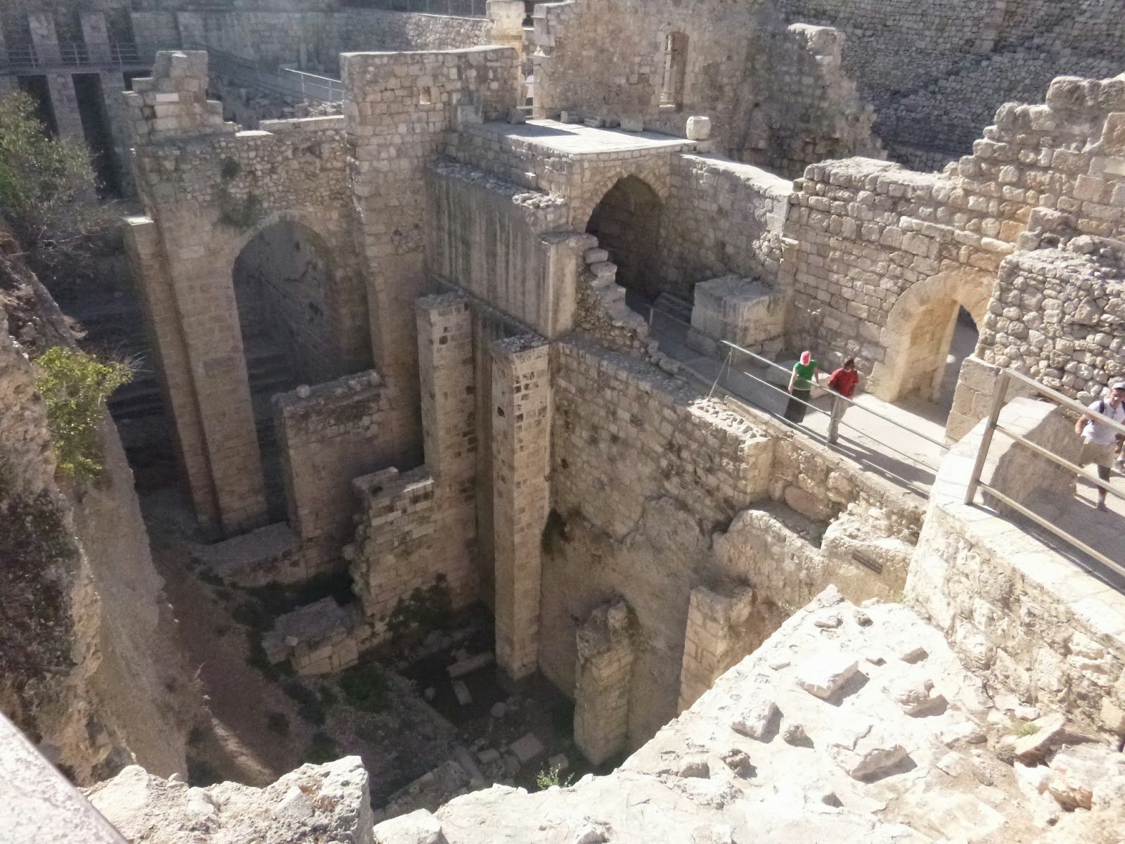
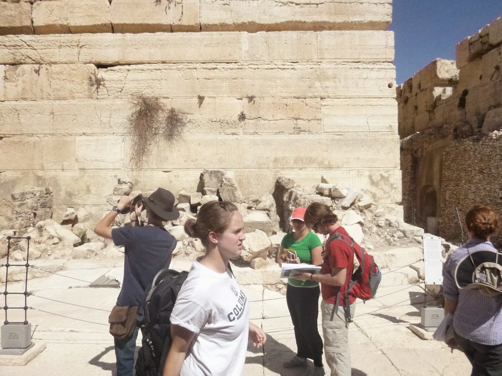
            That lead into our walking around the south and south west section of the retaining wall. Looking at Robinson's arch, what would have been a very large multi-section staircase up to the temple mount. We also looked at the ritual baths known as “Micvahs,” where one would go to be ceremonially cleansed. And we took a quick moment to look at “the place of the trumpeting to,” a section of stone that had that inscription. Lastly, the southern steps. Or did we go to the Davidson's after the southern steps? I cant recall. But it was all pretty great.
The corner where the trumpeting inscription fell


Saturday, September 21, 2013

Impressions

My first semester here I was required to do "impression reports" for the Physical Settings class, and I posted most of them to kill two birds with one stone.  Since I was required to write about our field studies, I figured I might as well use those to inform friends and family of what I had been doing as well.  Since this is Andrew's first time in Physical Settings, now it's his turn to write impression reports.  I'll be posting a few of them here too.  It won't be anything especially new for those of you who have either read my blog or have been here yourself.  Still, it's always good to review, and it can be helpful to get a new perspective.  So, without further ado...Here are Andrew's thoughts on his first field study, supplemented with pictures from both him and me.

Impression Report, Old City Field Study
Andrew Sharp September, 9th, 2013

            We went to the garden outback where we discussed our blue books and tools and general class overview stuff. 
Then off we went. 
Out the gate...
Down the hill..
First we walked the watershed ridge, the high point of the mountains running north and south just west of the rift valley. The ridge was a “watershed” because it's the geographic point where water begins to go east into the valley or west towards the sea. This officially puts Jerusalem in a rain shadow, but not by much, and with the underground watershed being further west it catches much of what comes off the ridge, and funnels it into the underground springs that head east, one of which being the Gihon Spring.

On the watershed ridge, looking over to JUC and Mt. Zion
            Next we got a feel for land marks and major routes through the area in Old Testament times as well as the names of the valleys. Talking of the Hinnom valley, and how the western hill was not nearly so occupied as it is now (if at all) in the times of the Patriarchs.
            We discussed water conditions in light of the water park just across the valley from JUC. Mentioning how Israel has far less water than many places and how the fresh water is very valuable and shouldn't be wasted. And yet hundreds if not thousands are surely wasted at the park each year.
            After that we discussed the old wall, and it's different ages, where it should be built in order to best work as a defense, 
and Alana pretended Vernon was Jesus and played the part of Zacchaeus climbing a tree to see and hear him. 
View from the tree
The Old City Wall has been knocked down and rebuilt in varying degrees and times leaving the wall built out of stone that looks visibly somewhat different in cut. It was also not built on the steepest part of the hill, nor around mt. Zion for which some foremen were killed. The problem this posed was fairly simple. If your enemey must climb uphill just to reach your wall, he's moving slower, more susceptible to large stones tossed down the hill from over the wall, or arrows. Not to mention it's far more difficult to use a ladder or battering ram in those conditions, and any hook and rope system used to pull the wall down would need to be very very long, to avoid pulling the rock down on top of your men.
            Next into the old city and through Zion Gate, then out into the parking lot to look out towards the south and east, orienting ourselves and looking towards the city of David and the Tyropean valley between. It turns out Orienting yourself is facing east, as the east is the direction of the Orient. Which puts the mount of olives directly into our range of vision, way out past the temple mount.
            Then the Cardo. 
The Cardo is the name to the central street in town that runs north south, and the main street running east west was called the Decumanus. Being used to divide a city into easy disctricts, it was a Roman concept as they liked cities squared, and symmetrical. Here we stopped in the cool of the shade and imagined the many different vendors selling their wares to travelers. An image not too hard to imagine. Even these days going down the streets in the Old City is similar, many merchants and stores, all trying to get you to come take a look and purchase their wares.
            Then we went off to the western wall observation point, and back above the old Cardo. 
Then finally off to the church of the Holy Sepulcher. 
Inside we went to the chapel of Adam under Greek Calvary where Adam is believed to have been buried according to Greek orthodox theology. And while we were there we had to wait while a ceremony was held over the stone of unction. The stone of unction being the kind of stone thought to have been used when removing Jesus body from the cross. One wonders how those large nails were removed. I'd imagine they would have been long enough that maybe they were driven through and out the back of the cross, and a hammer taken to the tip would help them come back out, if not, I can't imagine a quick easy way to do the job without damaging the body.
In the Syriac Chapel

            After that we went to the first century tomb and took a look around the rotunda and peeked at the Catholicon. Then we headed on out and home.

At another look-out point...Andrew finally escaped!


Tuesday, September 17, 2013

Saint Anne's

The melody rose and fell, lingering, shimmering in the air, adorning the plain, limestone walls of the crusader church with fantastic shapes and colors, formed from the living, moving sounds.


The church is large with grand, sweeping ceilings, but plain.  Ugly, even, by some standards, with its exactly mis-matched windows and pillars.  Nothing quite fits in.  Like the universal church: large, centuries old, and made of misfit human stones, with all their contrasts and conflicts.  But when both churches are filled with praise, then their true, ancient beauty shines through, undeniable.

Consortium Vocale Oslo - Encore at St. Anne's

Sunday, September 8, 2013

New Beginnings

Perhaps it's about time for the resurrection of the blog.  Those of you who know me personally (if anyone still reads this) will, no doubt, guess at the reasons for my long absence.  Basically, though back in Israel and still with many adventures to communicate, my communication was narrowed in to one certain person, who, a little over a month ago, became my husband.


We dated mostly online over the last year and a half, he came to Israel to propose, and I went home to Montana this summer to get married.  We are now back in Israel for what will be, for the foreseeable future, my last semester in Israel.  

We're still settling in, but we're excited for this semester and will hopefully have the chance to share here the adventures and thoughts we have together.