Showing posts with label Josephus. Show all posts

Saturday, March 17, 2012

First Field Study

 Saturday morning, a week ago, a small group of us were on the bus, bright an early, headed for the Judean Wilderness and two Herodian fortresses.  No, not the famous ones: Masada and the Herodium.  We were headed to two fortresses that most people will have never heard of: Hyrcania and Cypros.  
 
After we headed under the Mount of Olives and zoomed eastward, descending into the valley of the Dead Sea, green hills flashed by.  After a winter of record rainfall, the Judean wilderness was more green than I had ever seen it.  Green, and part of it, purple with wildflowers.  
 
I was on the wrong side of the bus to get very good pictures of the purple...but hopefully you can get an idea with these pictures.  It was pretty spectacular.  
We took a turn off Highway 1 at three signs that pointed to "An Nabi Musa," "Hureqanya," and "Wadi Og."  

We paused first at the bridge over the Wadi Og/Wadi Mukalik.  The last time I had been there, it was filled with water, rushing down from the hills near Jerusalem where it was raining.  This time there was no rain, and the wadi bottom was as dry as ever.  

Our next stop was one of the three small Iron Age sites in the Buqei'a Valley.  

Joshua 15:61-62 mentions six cities "in the wilderness:"   Beth-arabah, Middin, and Secacah, 
and Nibshan, and the city of Salt, and En-gedi.  We are more or less sure where three of those are: Beth-arabah, the City of Salt, and En-gedi are almost certainly near the Dead Sea.  Middin, Secacah, and Nibshan, on the other hand, are virtually unknown.  However, there are these three Iron Age sites which may fit the bill.  So we paused at the middle one.  If you have a map where they are labeled, it's probably labeled as "Secacah."

 It was excavated once in the 70's, before the Buqei'a became a place for the Israeli army to play war games.  We are standing here on the remains of the city wall.

We had a little free time to explore the site and we found some nice...
 ...wait, THAT'S not Iron Age pottery.

We took our bus a little bit further down the road before starting on of first major hike of the day: to Hyrcania.
 It's wonderful to find flowers in the wilderness (the hill of Hyrcania is in the background, to the left.)  Their beauty is not only refreshing in a barren wilderness, but serves as a poignant reminder of the truths of scripture:

A voice said, Cry! And he said, What shall I cry? All flesh is grass, and all its grace as the flower of the field!  The grass withers, the flower fades because the Spirit of Jehovah blows on it. Surely the people is grass.  The grass withers; the flower fades; but the Word of our God shall rise forever. 
~Isaiah 40:6-8

 We got closer....but it was still a hike.
 Once we got to the top we found bits of glass and looked at maps and read from Josephus.  We learned that Hyrcania was named after a Hasmonean king, and had been a fortress before Herod got to it.  Long after the time of Herod it became a monastery, and monks dwelt there even into the 1920's.
 Then we hiked back down on a beautiful grassy hill...again, more grass than I'd seen in this area.
 We delved into the tunnels, made famous by the copper scroll and Bob the pilot.
 We paused for lunch at An Nabi Musa, a Muslim monastery and the first stop on the pilgrim route from Jerusalem to Mecca.  It is named after Moses, and claims to have his tomb (the tomb in question dates to a much later time), but it was a nice place to eat lunch.

This is the view inside:
 And the view outside.  A lot of Muslim graves, and "Moses" tomb on top of the hill.

After lunch we continued down into the Jordan Valley and stopped by the New Testament site of Jericho, heading to Cypros.  This fortress had be built by Herod and named after his mother, a Nabatean princess.

There was still some water in the Wadi Qelt from recent rains, and we enjoyed the sound of running water as we hiked along it.
 
At one point the water grew especially loud.  Somehow, large amounts of water had escaped the aqueduct that also ran along the wadi, and it was running free along the road.  It watered the roots of this tree and reminded us of the man in Psalm 1.

As we approached the top of Cypros (which had housed an Israeli army base at one point) we found that the bunker tunnels that we normally entered through had collapsed.  We found a way over.  
 And then we spent some time on top looking studious.
After a good view of Jericho on top (including the Old and New Testament sites) and a good lesson and more reading from Josephus we found a different way down.
We walked along the wadi further and over looked the St. George's Monastery.  Unfortunately, by then, my camera batteries were dead.  For pictures you'll have to look back in time at a former post.  

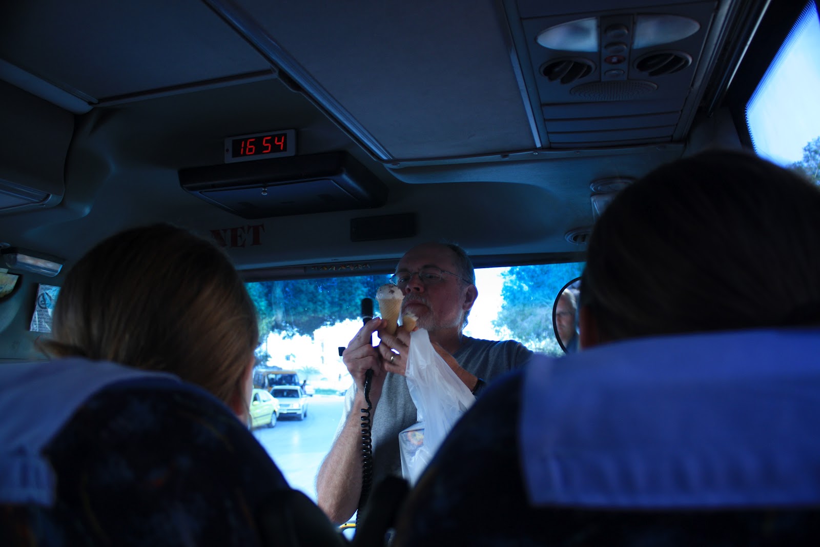
Dr. Wright decided it was a good day  for ice cream, and we had a little extra time, so we paused in Jericho at a little, brightly colored store, and all got a scoop of ice cream.
 
All in all, it's one of my favorite field studies (and the third time I'd gone).  We came home exhausted, but happy to have seen some rarer places, off the regular tourist route.  

Tuesday, April 28, 2009

Second Temple Galilee, Day 2

April 26, 2009

Today I got up relatively early to walk down to the shore of the lake. It was a beautiful morning, still and shining.  Some frogs were still singing, perhaps still trying to get their tiny tadpole babies to sleep.  No wonder Jesus loved being in Galilee.

After a quick breakfast we hopped on the bus and again headed into the eastern heights.  This time our destination was the famed site of Gamala - "the Masada of the North."  The site itself is pretty spectacular, a rocky and narrow hill, like Hippus with valleys on 3 sides and a narrow saddle on the 4th, looking down at the sea of Galilee.  There's a waterfall nearby, and eagles nesting in the cliffs.  
We clambered down the mountain and across the saddle to the remains of the synagogue where we paused to discuss site identification.  See, archaeological sites don't usually come with signs attached: "To the excavator:  Congratulations!  You've just discovered _____(name of site), mentioned by Josephus in _____(reference), and in the Bible in _______(reference)."  Instead, site identification uses a careful mix of references in ancient texts, modern toponymic connections, and archaeological finds to indentify a site.  Gamala, for instance, is described by Josephus much as I described both Hippus and Gamala, with the added detail that the hill of the city bore some resemblence to a camel's back.  He also includes some information about its location in a few texts.  Based on this sort of information, there have actually been a number of sites suggested as possible locations of Gamala.  One is Hippus.  Another, obviously, is the current site we were visiting, which currently bears the name "Gamala."  A third, though relatively close, is just over the border in Syria.  Hippus and Gamala have both been excavated, but the third site has not.  While at Gamala the archaeological evidence fits well with what we know took place there, it is not entirely convincing, at least to some.  My archaeology teacher finds it convincing, but then he is a Jew, and very pro-Israeli, and may have alterior motives for wishing to believe that Gamala is in modern day Israel.  It could be Gamala, but there are still questions and issues.  Perhaps they could be resolved by excavating the other site.  Archaeology: another reason to pray for peace between Syria and Israel.  How much we miss by not being able to go there!

After our discussion we had about an hour to climb and explore.  I went to the top of the hill which was covered by reasonably large boulders.  It reminded me of our boulder fields at camp.  I'd want to live there if I were a second temple Jew.  It's a beautiful area.  I'd rather prefer not to be there (or anywhere) when the Romans attacked, though.  Then we had the sweaty climb back over the saddle and up the hill to the bus.

On our way out we stopped at a Dolmen, which pretty much made my day.  The dolmens of Israel date to about the Intermediate Bronze Age (2200-1950 BC) and were probably used as burial structures.  We learned about them in archaeology last semester, so it was fun to actually see some.  
We made our way back to the other side of the lake, paused in a small town to buy some pita for lunch, and ended up by Jotapata (Yodfat).  After a quick lunch we hiked to the top of the hill where Jotapata had been located.  The basic geography of the city is just a variation on the same theme as Hippus and Gamala, though perhaps less dramatic than Gamala.  For those of you who have never heard of Jotapata, prepare for a short history lesson.  

During the first revolt of the Jews against the Romans (culminating with the destruction of Jerusalem in 70AD), Josephus, a priest from Jerusalem, was assigned to be commander of the Jewish forces in Galilee.  To make a long story short, he was at Jotapata when it fell to the Romans and he was captured.  He managed to ingratiate himself with the commander of the army and became their advisor.  For a  more detailed account you can read what he says about himself.  

So we spent a little time looking around Jotapata, exploring a few of the many caves, perhaps even the one where Josephus hid for a while.  Then we walked, stumbled, slid, and otherwise traveled down the hill.  At the bottom we followed a dirt road for a mile or so until it passed the hill of Khirbet Qana, overlooking the Netopha Valley.  
This is the most likely location of Cana, the place where Jesus performed his first miracle, turning water into wine.  It was a beautiful, clear day, and from the top of Cana we could see Nazareth, Sepphoris, Gath-hepher (home town of Jonah - 2 Kings 14:25), Hannathon, and even, in the distance, the rise of the Carmel Range.  This is the area where Jesus grew up.  He probably had relatives in Cana, thus explaining why he attended a wedding there.  This agricultural region of his youth is probably where he got the imagery for most of his parables.  

We walked down the hill and went further down the dirt path along the edge of the valley to where the bus met us.  It's kind of strange seeing wheat ripening in April when back home it probably hasn't begun to sprout.  From there we headed back to Jerusalem.

It was a good trip.  The smaller group was nice.  Much food for thought.  It was nice to walk and hike and see new sites.  The weather was pretty much perfect, which helped too.  Actually, it was just nice to be in the field (with Dr. Wright) again.  I've missed that this semester.